 Blue Dolphin
 Chapter 9 of 16
Routes: plan the trip in advance
Just go somewhere: “Go here”
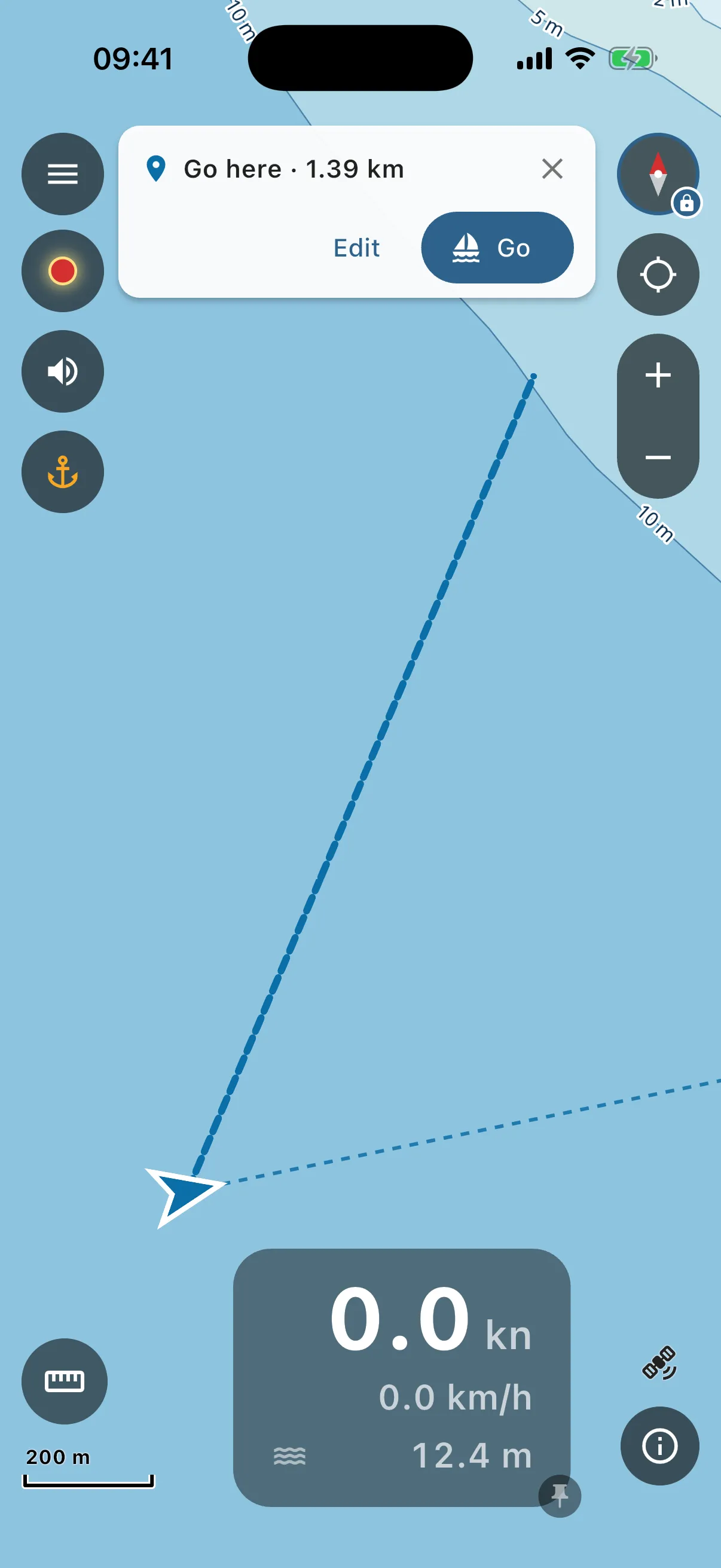
- Long-press the spot you want to reach and tap “Go here” in the ring menu.
- The app works out a safe route from your boat (a small “Finding a safe route…” note while it thinks, long passages take a few seconds) and draws it dashed on the chart, with a card on top: the distance, “Edit” and “Go”.
- “Go” and you are on your way: the route stays on the chart and the panel at the bottom starts counting it down (see Following a route). Nothing is saved, nothing to name. “Edit” opens it in the route editor if you want to change it or keep it. The ✕ drops it.
No safe route? Destination too close to the shore, or the water in between too shallow for your boat: the app says so, and the line is drawn red and straight. Pick a point a bit further out, or plan it in the editor with a waypoint in between.
Plan a route point by point
Open menu → Trips → Routes → ”+”.
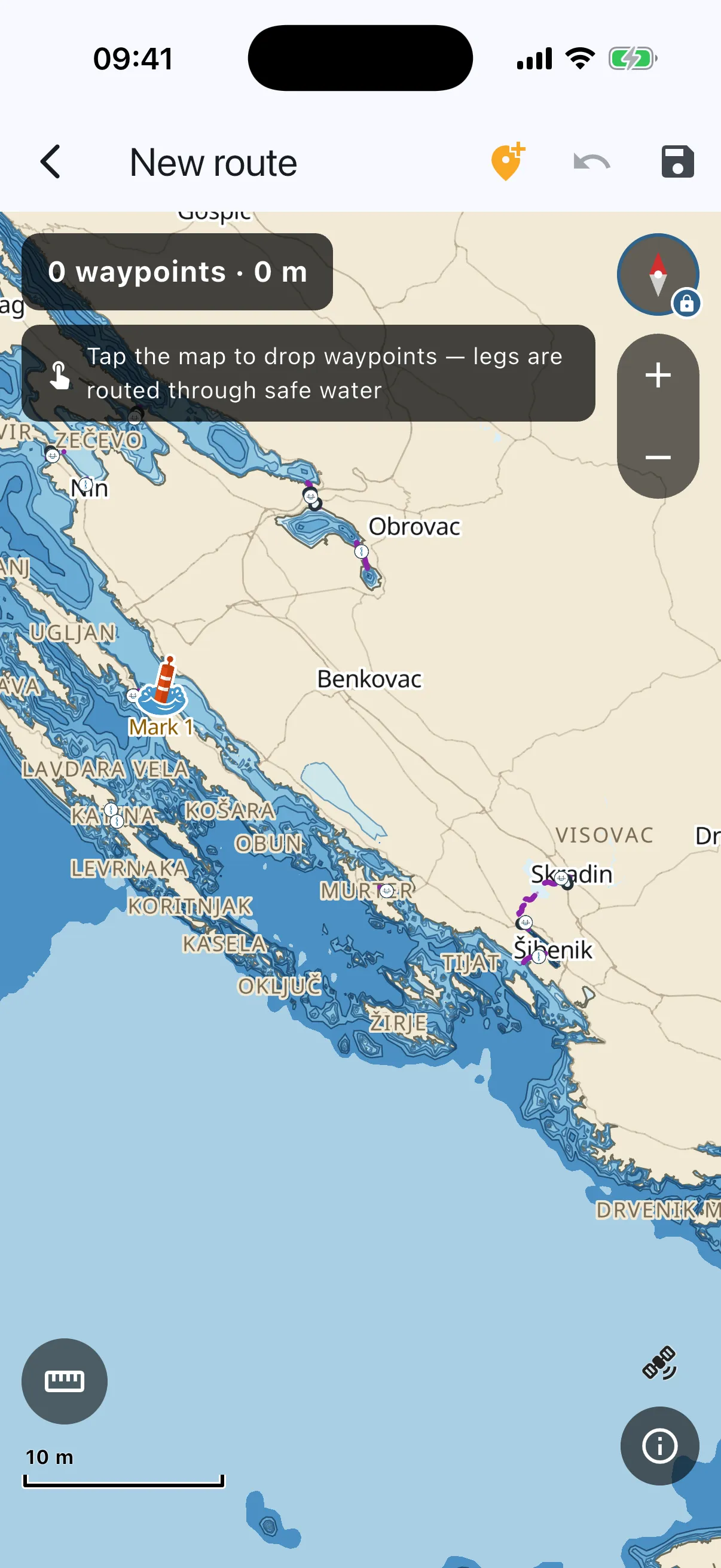
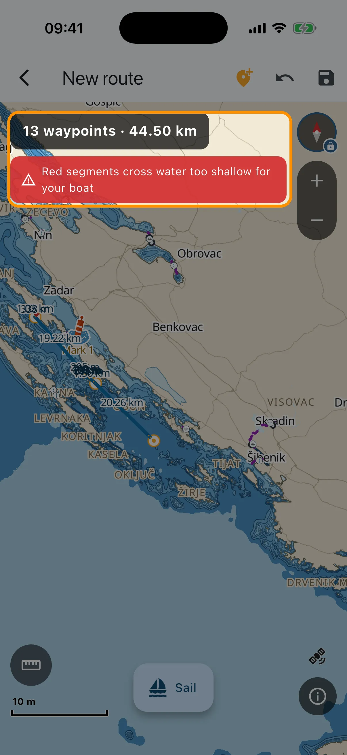
- Tap the chart where you want to go, point by point. After each tap the app routes the leg for you: through safe water, around islands, through the marked strait channels, never over land. The chip at the top counts waypoints and total distance. Every leg is labelled with its length on the chart.
- Drag a waypoint to move it, the safety check redraws the legs red or blue at once. Drag the small amber handles to bend a leg into a curve. Long-press a waypoint to delete it. The ✚ button in the top bar arms and disarms tap-to-add.
- Undo takes back your last change, whatever it was: a tapped leg, a drag, a deleted point.
- Watch for red. Any stretch of the route that crosses water too shallow for YOUR boat (draft + margin, from Your boat), or passes under a bridge your mast cannot clear, is drawn red with a hint explaining why. The same rules the auto-router uses judge your manual edits, so an officially dredged channel is not falsely flagged.
- Grey dashed bits at the very start or end are not a warning. That is the way in and out of a marina or a bay right at the shore, which the chart data is too coarse to see. Those last few hundred metres are your eyes, not the chart’s.
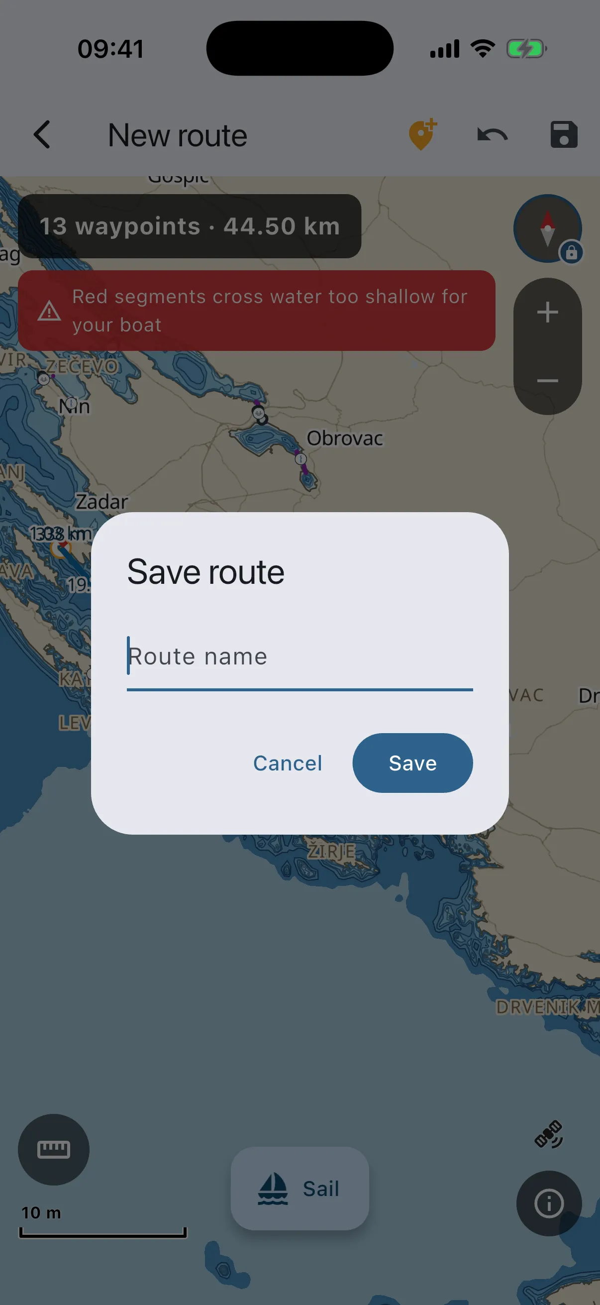
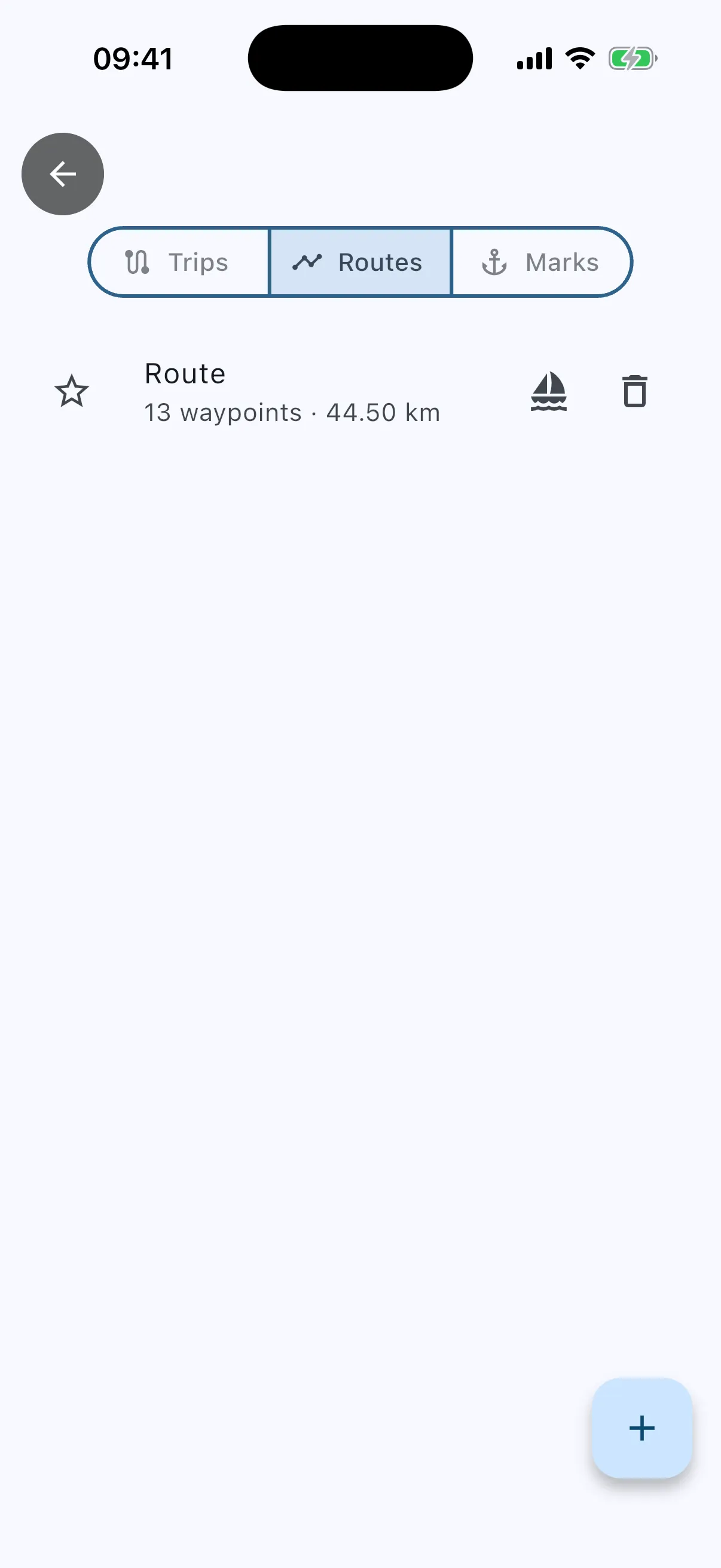
- Save (disk icon) and give it a name. Routes live in Trips → Routes. Favourite them, delete them, reopen and edit them, all offline. Leaving the editor with unsaved changes asks first.
Following a route
On the day: open the route and tap “Sail” (or “Go” on a Go here card). The route stays on the chart and a chip with its name sits at the top.
- The arrow on top of the speed panel points the way to the next waypoint, and three lines in the panel show the course to steer, the distance to go and your arrival time (see Your speed and the numbers).
- Drift more than 100 m off the line and the chip turns amber, “Off course”. Further off, the app reroutes you from where you are: the chip says “Rerouting…” for a moment.
- Round trips are fine. Out to the island and back to the same marina, the app keeps track of which way you are going, so it never jumps to the last leg while you are still leaving the berth.
- The screen stays on while you follow a route (Settings → “Keep screen on while navigating”).
- The ✕ on the chip stops it.
- Phone killed the app on the way? The next time you open it, it asks “Resume your last route?”.
No boat profile set? The first time you plan or follow a route, the app asks: set up the boat now, or use the cautious defaults (1.0 m draft, no bridge checks). Set up the boat for real answers.