 Blue Dolphin
 Chapter 4 of 16
Your speed and the numbers
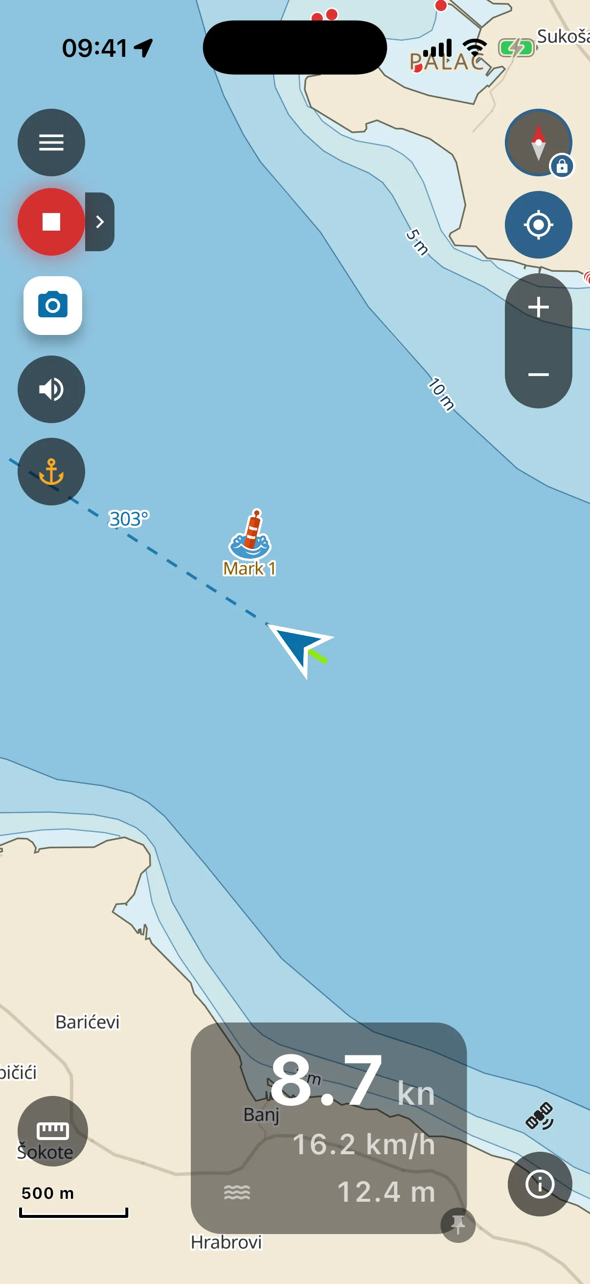
The panel at the bottom of the chart is your instrument cluster:
- Speed in knots, the big number. Boat speed is always in knots. That one is not a setting.
- The same speed in km/h (or mph, per your Units choice) underneath, for crew who do not think in knots yet.
- Charted depth under the boat. From the chart, not from a sensor: it reads the depth data at your position. Treat it accordingly (see What this app is not).
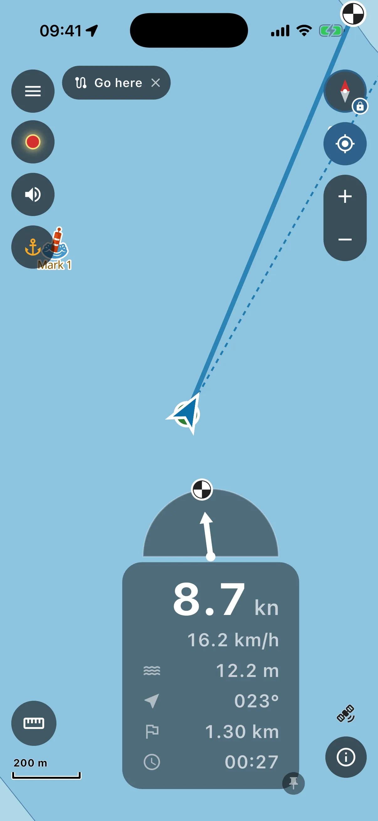
Following a route or heading to a mark? Three more lines appear under the depth, and an arrow sits on top of the panel:
- Arrow icon: the course to steer for the next waypoint, in degrees.
- Flag icon: distance still to go along the route.
- Clock icon: your arrival time at the current speed.
--:--while you are barely moving, an arrival time from drifting speed means nothing. - The arrow above the panel points the way to turn for the next waypoint, straight up means you are on it. The small buoy or flag on its rim shows where the final destination is.
Before the first GPS fix the panel says “waiting for GPS” instead of numbers. The small satellite icon next to it shows fix quality.
The panel is yours to move: tap the small pin on its corner to unpin, then drag it anywhere and pinch to resize. Bigger numbers for the flybridge, smaller for a kayak deck. Pin it again and it stays put.
While you move, your track draws behind the boat, coloured by speed: green where you were slow, red where you were fast. Recording a trip keeps that track (see Trips).