 Blue Dolphin
 Chapter 3 of 16
Moving around the chart
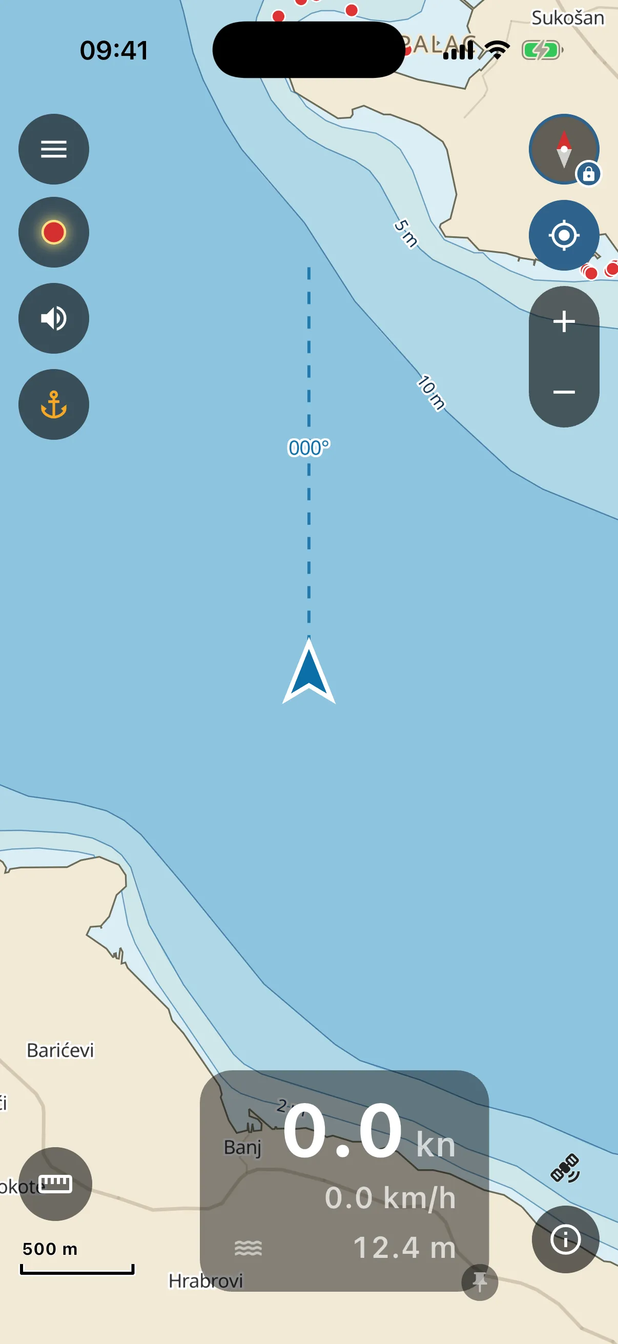
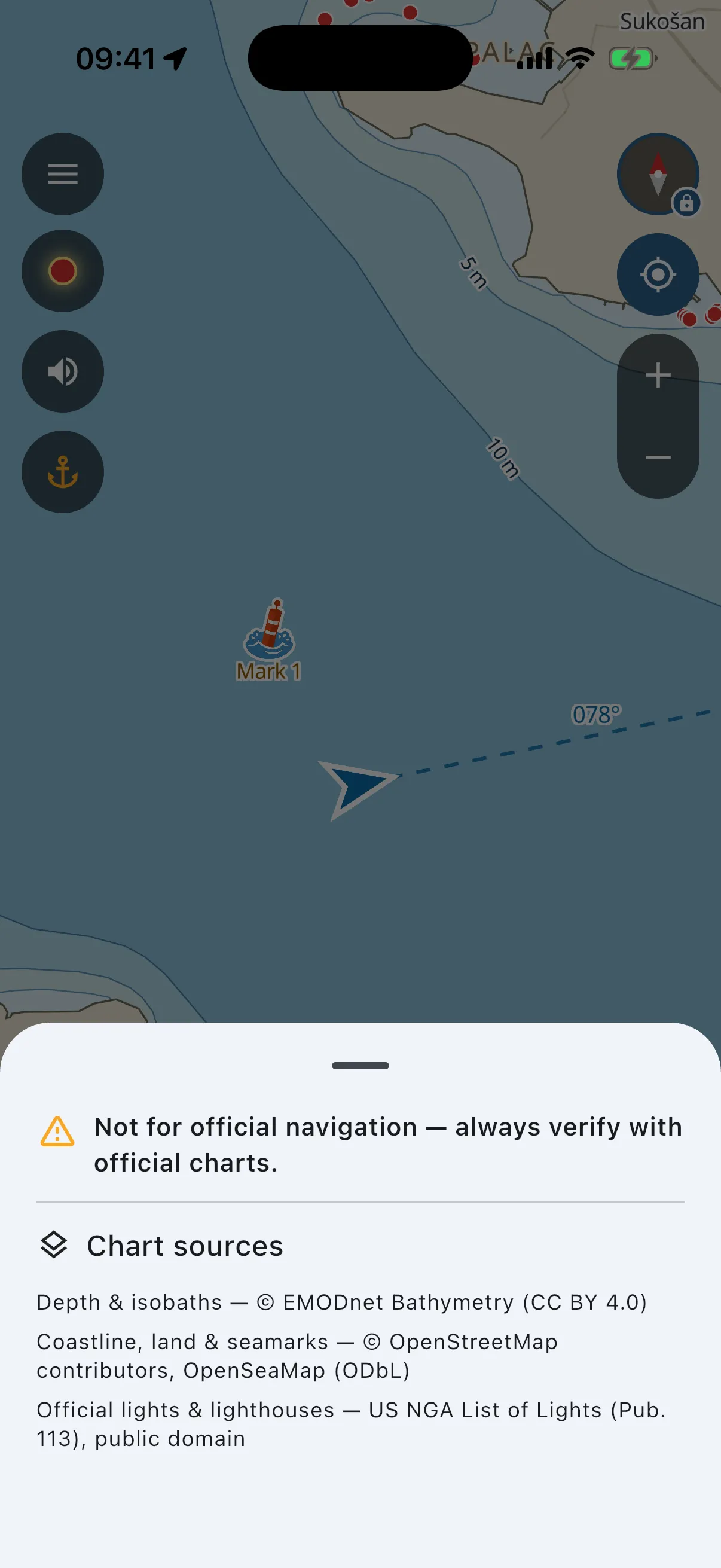
The chart behaves like every map app you know: drag to pan, pinch to zoom, two-finger twist to rotate. What is specific to Blue Dolphin:
- Depth shading. The lighter the blue, the shallower the water. Isobath labels (2 m, 5 m, 10 m…) are written on the chart itself.
- Seamarks appear as you zoom in. Buoys, beacons, lights. Zoomed out you see only the major lighthouses, the smaller lights join as you zoom in, so the chart stays readable. Tap any of them and the app explains in plain words what it is (“green conical buoy, leave it to starboard when returning from sea”, light rhythm and colour, and so on). Lighthouses pulse with their real rhythm.
- The compass (top-right). Tap it to cycle how the chart faces: north-up locked, course-up (the chart turns with your boat, the way most people drive), free rotation.
- Zoom + / − under the compass, for one-handed use in chop. Pinching works too.
- The locate button. Back to your boat, chart follows again (see Where is my boat?).
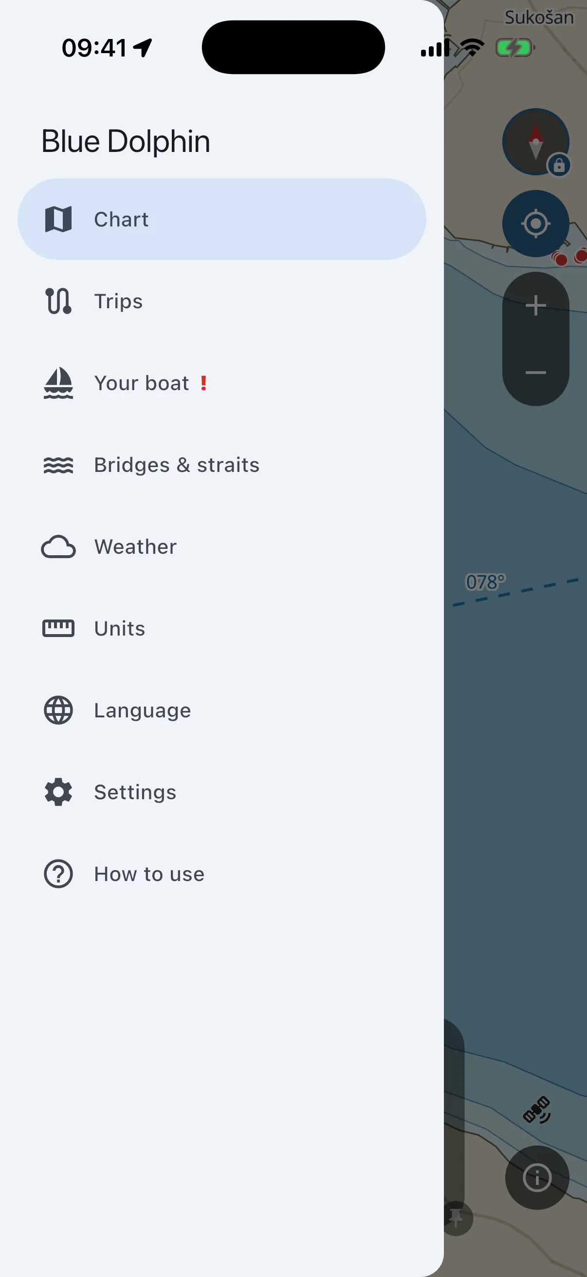
- The hamburger (top-left). The main menu: Chart, Trips, Your boat, Bridges & straits, Weather, Units, Language, Settings, and How to use (this guide). Everything that is not the chart lives here.
- The anchor button (left, under the speaker). One tap saves a mark exactly where your boat is (see Marks).
- The ⓘ button (bottom-right). Chart sources and the “not for official navigation” reminder. It glows when you are near a locally surveyed feature the standard sources do not have (for example the dredged channel at Privlački gaz). Tap it and it credits that source too.
- The speaker button mutes warning sounds. The visual warnings and the vibration stay.
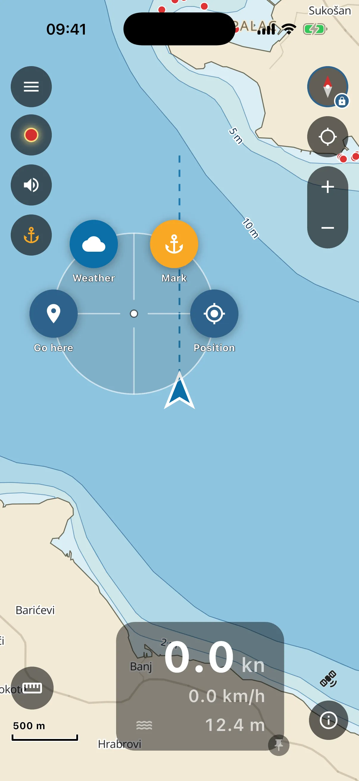
Long-press anywhere on the chart and a small ring menu opens around your finger. Tapping your own boat arrow opens the same menu. The four bubbles: